-
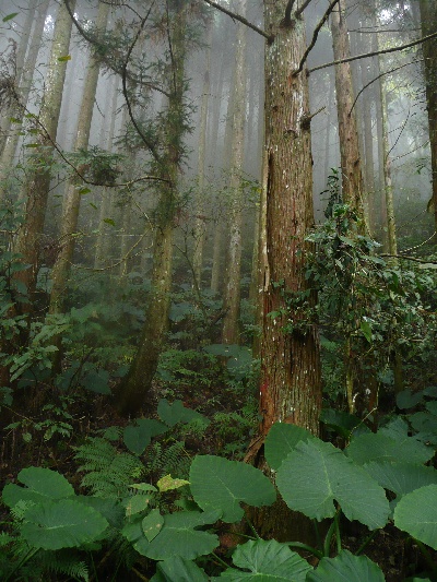
羅山林道南線 Luoshan Forest Road south branch

Technically easy but actually challenging because of its length and irregular conservation state, the Luoshan Forest Road it is a good bit of adventure.
Spéléo en VTT ? 慢走 ! 在羅山林道南線雖然不難騎但是不可以騎得很快。。。

La première fois que je suis entré dans un tunnel en travaux c'était à Marseille, perdu sur un chantier de rocade, et je réussis à le traverser. La deuxième fois, eh bien c'était dimanche dernier en VTT dans le comté de Hsin Chu... et je n'ai pas réussi à le traverser. Je dois préciser que je m'y étais déjà pris à deux reprises cet automne, mais un préposé de la police municipale posté à un barrage routier m'avait gentiment demandé de faire demi-tour. C'est que derrière ce tunnel je voyais un bel enjeu : rejoindre le haut d'une piste forestière de trente kilomètres, la route forestière de Luoshan.
Alors cette fois-ci j'avais mis tous les atouts de mon côté : arrivée de très bonne heure avant le barrage de la route et les ouvriers, éclairage en parfait état de fonctionnement, sans oublier l'équipement complet pour affronter la brousse subtropicale ainsi que ses charmants habitants. Mais une fois pénétré dans les ténèbres de ce fameux tunnel du plus profond que je pusse, je dus bien me résoudre à l'inéluctable : la voie était sans issue, complètement obstruée de blocs de pierre. Devant tant d'adversité je me résolus à faire demi-tour et à attaquer la route forestière par le bas...


This was not the first time I planned to ride mountain bike on the Luoshan forest road, south branch (羅山林道南線) and here is the reason : with its 30km winding around the mountains it is the longest unpaved road in northern Taiwan which is legally open to visitors. Whah ! Moreover this road can be reached from the top, what makes a potential 30km downhill... Well, just potential however - since there is no evidence that the road is rideable and also there are some technical difficulties to reach the top, for instance the Taoshan Tunnel on Nanqing Road is still obstructed (桃山隧道,南清公路).
I was very ambitious when I arrived at the lower entrance of the forest road and decided to ride the whole 30km up and then back downhill. I owed this positive attitude to my excellent memory of the Luoshan forest road, north branch, which lies just besides. Hmm, five kilometers later, after a long carry section over a landslide I changed my mind and decided that 10km would already be a good achievement. And a few hours later, because of the vagaries of weather I found that 8km would be a safer target ... that's a very slow pace, but as the chinese hikers greet each other : 慢走 !(go slowly !)


羅山林道南線是一個奇遇的地方. 因為林道比較平,所以騎登山腳踏車通常不難。可是有時候可以騎的很快,然後突然沒有林道了!除了第一個四公里,林道沒有維修。雖然道路長長很容易看得見,但是破壞的部件一直沒有修理。我就覺得騎這裡,最好很小心。因為我不喜歡冒險,所以騎自行車騎的很慢。在危險的部件我也花了點時間維護林道:剪切一些太低的樹枝,剪切一些植被。還是不夠理想!雖然還有冒險我覺得回程騎下去很好玩。
因為沒有維修,所以單車人常常需要停止。在兩個部件,因為林道全破壞了, 所以必須攜帶腳踏車差不多五十公尺。在別的停止,推還是攜帶腳踏車比較短。在羅山林道南線,你知道甚麼時候離開,可是你不知道甚麼時候回來,而且你总是必須注意力。就是說奇遇!因為我喜歡奇遇可是不喜歡冒險,所以我大概回來在騎羅山林道!

Additional information 其他資料:
Date 日: November 28th, 2009年11月28日
Temperature 溫度: 14 Celsius
Participants 參加人: Alexis
Access 通路: No public transportation. Drive or ride to Jhudong (竹東) then Nanqing road (南清公路 122) to Wufong, then small roads to Jhulin (竹林).
Drinkable water 飲用水: Spring water after the work station and at 8km
Permit 登山證: No
Itinerary 行程: At the work station in a turn 1.7km from the beginning of the road, quit the large gravel road and head straight downhill on a narrow paved track. Join another gravel road and follow it until the end...
 Tags: wufong, luoshan, grade 2, tunnel, no stairs, slow riding, downhill
-
Comments
和平與騎 Take a ride on the wild side


Magnifique blog, très très belles photos, j'aimerais moi
aussi aller m'y balader à vélo...