-
Par aleski le 12 September 2010 à 15:31

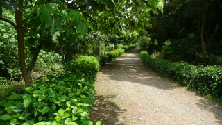
An easy route rich in Feng Shui and scrub...
全路資料 
高差: 110公尺
類型: 循環Global route
Elevation gain: 110m
Type: Loops越野細節 
級: 2+ 容易
質量:
#1中 #2低
攜帶: 不用Off-road details
Grade: 2+ - Easy
Track quality:
#1 Medium #2 Low
Carry: No your comment
-
Par aleski le 1 September 2010 à 16:41

This riding sector is the most popular offroad area in Hutoushan, and also the most technical. The main tracks are very well maintained.
全路資料 
高差: 110公尺
類型: 循環Global route
Elevation gain: 110m
Type: Loops越野細節 
級: 2到6
質量: 很好
攜帶: 不用Off-road details
Grade: 2 to 6
Track quality: Excellent
Carry: No your comment
-
Par aleski le 25 August 2010 à 10:14

雖然虎頭山公園主要是走路散步的地方,但是這裡有一些很有意思的道路。有的比較平騎, 有的上坡去,也有的下坡去。The Hutou Mt. Park is mainly dedicated to hiking, however there are some very interesting itineraries to ride whatever flat, uphill or downhill.
全路資料 
高差: 140公尺
類型: 循環Global route
Elevation gain: 140m
Type: Loops越野細節 
級: 1到3 - 容易
質量: 很好
攜帶: 不用Off-road details
Grade: 1 to 3 - Easy
Track quality: Excellent
Carry: No your comment
-
Par aleski le 30 July 2010 à 14:19

Large gentle dirt roads as well as narrow super steep singletracks. The Belvedere is a really playful area, including some challenging ride exercises.
全路資料 
高差: 100公尺
類型: 循環Global route
Elevation gain: 100m
Type: Loops越野細節 
級: 2到4 - 容易到艱級
質量: 好
攜帶: 不用Off-road details
Grade: 2 to 4 - Easy to Dfiicult
Track quality: Good
Carry: No your comment
-
Par aleski le 20 June 2010 à 17:55

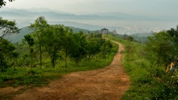
A scenic ridge hiding abandoned singletracks, which should fulfill the wilderness lovers.
全路資料 
高差: 90公尺
類型: 循環Global route
Elevation gain: 90m
Type: Loops越野細節 
級: 3到4:中級
質量: 好不好都有
攜帶: 很少Off-road details
Grade: 3 to 4 - Intermediate
Track quality: Variable
Carry: Little 1 comment
 Follow this section's article RSS flux
 Follow this section's comments RSS flux
和平與騎 Take a ride on the wild side


